
Reviewed · HELICOPTER TOURS
30 Minutes SHARED Helicopter Tour in Honolulu
Oahu makes the most sense from the air. In half an hour, this small helicopter flight sweeps from Sand Island and Honolulu Harbor across Waikiki and Diamond Head, then inland toward Punchbowl, Moanalua Gardens, H-3, and Aloha Stadium. The three-person limit keeps the ride personal, and pilot commentary gives the views some meaning instead of leaving you to guess at every beach and highway.
I like two things right away: the intimate cabin, which is a far better setup for photos than a packed sightseeing aircraft, and the wide range of scenery. You see beaches, city towers, a volcanic crater, memorial grounds, golf greens, highways, and mountain routes in one compact flight. Pilots such as Stefan and Scott have been praised for being friendly, thorough, and helpful with families.
The catch is the price: $319 per person for about 30 minutes. That is a serious splurge, and the route moves quickly, so this suits you best if you value a rare overview of Oahu more than a long, relaxed flight over one small area.
In This Review
- Key details before you book
- Why a helicopter is the right view of Oahu
- From HNL to Sand Island and Honolulu Harbor
- Ala Moana Beach Park, Magic Island, and Ala Wai Harbor
- Waikiki and Diamond Head from above
- Waialae and the Honolulu city center
- Punchbowl Cemetery and the inland turn
- H-3, the Ko’olau Range, and Aloha Stadium
- What the $319 price really buys you
- Timing, weather, and practical details
- Who will enjoy this flight most
- Should you book the 30-minute Oahu flight?
- FAQ
- How long is the helicopter tour?
- Where does the tour start and finish?
- How many people can join the flight?
- What places can I see from the helicopter?
- Is commentary included?
- Is there a weight limit?
- What happens if the weather is poor?
- Can I cancel for a refund?
Key details before you book
- Three guests maximum: This is a small shared flight, not a large sightseeing ride.
- A broad Honolulu route: Expect coast, city, Diamond Head, Punchbowl, Moanalua Gardens, H-3, and Aloha Stadium.
- HNL departure and return: The meeting point is 1 Lagoon Drive at Honolulu International Airport.
- Pilot-led sightseeing: Your pilot provides commentary through an aviation headset.
- Useful photo setup: A cell phone lanyard is included, and the open-door flight option has been praised by passengers who used it.
- Weather matters: Poor conditions can lead to a new date or a full refund.
Why a helicopter is the right view of Oahu
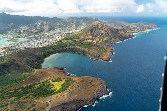
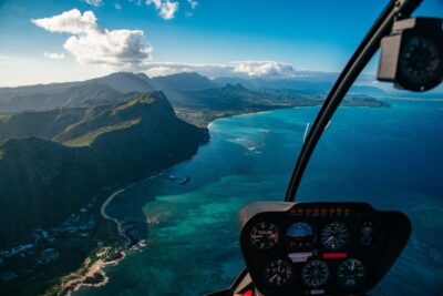
Oahu is easy to admire from ground level, but the island’s shape and connections become clear from above. Waikiki appears as a narrow strip of hotels and beach, Diamond Head rises behind it, and the Ko’olau Range forms the green mountain wall farther inland.
That broad view is the main reason to consider this flight. You are not simply looking down at familiar sights. You are seeing how Honolulu Harbor, downtown, Ala Moana, Waikiki, and the inland roads fit together.
The small aircraft also changes the feel of the outing. With no more than three guests, you avoid the scale of a large group excursion. That matters when you want the pilot’s explanation to feel relevant to what is passing below, or when you are trying to frame a photo without a crowd around you.
Aviation headsets are included, so you can hear the pilot during the flight. The phone lanyard is a practical touch, especially if you are using your phone for photographs and want an extra measure of security while looking down from the aircraft.
The flight lasts about 30 minutes. That is long enough for a strong overview, but not long enough to linger over every location. I would approach it as a fast, carefully packed tour of Honolulu and nearby Oahu, not as a slow scenic ride.
More helicopter flights over Oahu:
- Royal Crown of Oahu – 60 Min Helicopter Tour – Doors Off or On
★ 5.0 · 755 reviews - Oahu: 45 Minute Sights Unseen Helicopter Tour – Doors Off or On
★ 5.0 · 477 reviews - From Honolulu: Oahu 60min Helicopter Tour with Doors Off/On
★ 4.9 · 340 reviews
From HNL to Sand Island and Honolulu Harbor

The tour starts and ends at HNL, with the stated meeting point at 1 Lagoon Drive. The first part of the route introduces the working side of Honolulu, beginning around Sand Island and Honolulu Harbor.
Honolulu Harbor is the state’s main seaport. From the air, its docks and shipping areas offer a useful contrast to the resort coast. You see the machinery of an island city, not only the postcard beach.
That contrast is one of the flight’s strengths. A ground tour can make Honolulu feel like a series of separate districts. From the helicopter, the harbor, downtown, waterfront, and beach areas appear as parts of one compact urban center.
Sand Island adds another practical piece of the picture. It is not included because it is a famous beach stop. It helps show the port and industrial edge of Honolulu before the route shifts toward the parkland and resort coast.
Ala Moana Beach Park, Magic Island, and Ala Wai Harbor
The route continues past Ala Moana Beach Park, a large public park between downtown Honolulu and Waikiki. Its broad golden beach and open park area are easy to distinguish from the dense hotel district next door.
Ala Moana is especially interesting from above because it shows how much open space sits beside the city. The park covers about 100 acres and has a beach more than half a mile long. That scale is difficult to appreciate when you are walking along the shore.
Next comes Magic Island, the man-made peninsula beside the park and Ala Wai Yacht Harbor. It was created in 1964 for a planned resort complex and later became a public park. The name Aina Moana is official but not commonly used.
Ala Wai Harbor marks the transition into Waikiki. It is Hawaii’s largest small-boat and yacht harbor, positioned between Waikiki and downtown at the mouth of the Ala Wai Canal. From the air, you can read the geography clearly: Waikiki and Diamond Head to the east, Magic Island and the Honolulu waterfront to the west.
This section of the flight is good for orientation. You see the park, peninsula, harbor, canal, and resort district in one view. The possible drawback is that the helicopter does not stop. Your time over each feature is brief, so keep your phone ready and listen for the pilot’s cue.
Waikiki and Diamond Head from above
Waikiki is the visual centerpiece for many people. Its high-rise hotels line the shore, and the beach forms a bright strip between the Pacific and the city. From the helicopter, the density of Kalakaua Avenue and the surrounding streets becomes part of the view.
You may also spot the district’s familiar attractions, including the Honolulu Zoo and Waikiki Aquarium area. The flight does not provide admission to either place, and you do not land there, but the aerial perspective gives you a useful sense of where the beach, hotels, shops, and public spaces sit.
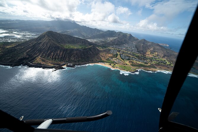
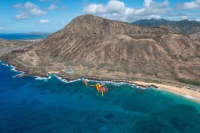
Then the route reaches Diamond Head, known to Hawaiians as Lēʻahi. This volcanic tuff cone is one of Oahu’s clearest landmarks, with a ridgeline often compared to the dorsal fin of a tuna.
Diamond Head is impressive from the ground, but an aircraft gives you the full volcanic form. You can see the crater shape and its position behind Waikiki, a relationship that is harder to grasp from the beach.
This is also one of the best parts for photos. If you choose an open-door flight option, as some passengers have, you may get a cleaner view without glass in front of the camera. Confirm the current door arrangement and safety requirements when booking, since the supplied tour details do not spell out the option as a standard inclusion.
Same island, a completely different kind of day:
- Oahu Grand Circle Island and Haleiwa Tour: 9-Hr Deluxe Experience
★ 5.0 · 17,387 reviews - Oahu: Grand Tour Around Island 16 Locations plus Snorkeling
★ 5.0 · 8,669 reviews - Parasailing Experience in Waikiki, HI
★ 5.0 · 7,692 reviews - Salute to Pearl Harbor Including USS Arizona
★ 4.5 · 7,433 reviews
Waialae and the Honolulu city center
Beyond Diamond Head, the flight passes Waialae Country Club in East Honolulu. The private course is a par 72 championship layout designed by Seth Raynor, extending to 7,125 yards from the championship tees.
You will not be visiting the golf course, but its patterned fairways make an easy visual marker from above. The manicured greens contrast with the darker volcanic slopes and dense city blocks nearby.
The route then turns toward downtown Honolulu. This is Hawaii’s political and business center, with office towers, government buildings, and the restored Iolani Palace. From above, downtown also connects back to the harbor and Aloha Tower waterfront.
Aerial sightseeing gives you the city’s structure in a way a street walk cannot. You see where the older civic core ends, where the port begins, and how the modern towers cluster along the waterfront. The trade-off is detail. You will not be able to inspect palace furnishings or museum displays from the helicopter, so pair this flight with a ground visit if those sights interest you.
Punchbowl Cemetery and the inland turn
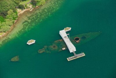
The National Memorial Cemetery of the Pacific sits inside Punchbowl Crater. It honors people who served in the United States Armed Forces, including those who gave their lives.
Seeing the cemetery from above calls for a quieter kind of attention. The crater setting gives the memorial a strong physical frame, and the aerial angle helps you understand why this site is such a prominent part of Honolulu’s geography.
The flight also passes the H-201 interchange, part of the Moanalua Freeway system. Highways may sound less scenic than beaches, but they help explain how Honolulu functions. The road network threads through a narrow area between the ocean and mountains, and that becomes plain from the air.
Moanalua Gardens follows, a privately owned public park covering 24 acres. It contains the Kamehameha V Cottage, once home to Prince Lot Kapuāiwa, who later became King Kamehameha V. It is also known for the large monkeypod tree called the Hitachi tree in Japan and for the annual Prince Lot Hula Festival.
From a helicopter, the gardens offer a patch of green relief amid the roads and buildings. You should not expect a detailed look at the cottage or tree during this fast pass, but the route gives you a useful preview if you plan to visit the area later.
H-3, the Ko’olau Range, and Aloha Stadium
One of the most distinctive inland sights is Interstate H-3, also called the John A. Burns Freeway. It crosses the Ko’olau Range on viaducts and through the 5,165-foot Tetsuo Harano Tunnels, along with the smaller Hospital Rock Tunnels.
This is where the flight moves beyond the familiar Honolulu postcard. The highway’s route through the mountains shows the engineering challenge of crossing Oahu’s interior. You get a quick sense of the scale of the Ko’olau Range and the narrow corridors used by roads.
The H-3 section may be especially valuable if you have driven it, plan to drive it, or simply want to understand the island beyond Waikiki. It is a reminder that Oahu is more than a resort shoreline.
The route also includes Aloha Stadium in Halawa. The stadium was Hawaii’s largest multi-purpose stadium, though it stopped hosting events with fans in December 2020 and has remained closed to those operations.
Like the highway, Aloha Stadium is more useful as geographic context than as a classic sightseeing stop. It helps locate the western side of the Honolulu area and rounds out the route before the helicopter returns to HNL.
What the $319 price really buys you
At $319 per person, the flight costs more than most short Honolulu activities. You are paying for the aircraft, pilot, airport operation, a very limited group size, and a view that cannot be duplicated from a road, beach, or lookout.
The value improves if you want a single activity that covers many parts of Oahu. In 30 minutes, you see the resort coast, public parks, the harbor, downtown, memorial grounds, mountain roads, and Halawa. A ground itinerary covering all of those places would take much longer and require more planning.
The price is harder to justify if your main goal is one landmark. If all you want is a good look at Diamond Head, a ground viewpoint or hike may offer more time at a lower cost. This tour makes more sense when the overall aerial perspective is the point.
Group discounts are available, which may help if you are booking with others. The flight is shared, but the maximum of three means you are not being placed in a large sightseeing group. The experience is offered in English.
The published rating is 5 out of 5 from 27 ratings, with 100 percent recommending the experience. Specific praise has focused on the smooth flight, professional crew, helpful staff, and pilots such as Stefan and Scott. That does not remove the usual limits of a short aircraft tour, but it does point to strong service as a central part of the experience.
Timing, weather, and practical details
You receive confirmation at booking, and the experience is near public transportation. The tour begins and ends at 1 Lagoon Drive, Honolulu, Hawaii 96819, at HNL.
The stated total weight limit is 300 pounds per passenger. Treat that as an important booking condition, and check how the operator applies it if more than one person is booking together.
Most people can participate, but the flight requires suitable weather. If poor weather cancels the experience, you can choose another date or receive a full refund. The same type of alternative or refund applies if the minimum number required for the flight is not reached.
Free cancellation is available until 24 hours before the start time. Cancel inside that 24-hour window and you will not receive a refund, and changes made during that period are not accepted.
The tour is booked, on average, 32 days in advance. That is a useful warning for a small aircraft with only three places. If the flight is important to your Oahu schedule, reserve early and leave some flexibility around the date in case weather affects the operation.
Who will enjoy this flight most
I would recommend it most to first-time visitors who want a quick mental map of Oahu. It is also a strong choice for repeat visitors who have seen Waikiki from the ground and want to connect familiar places with the harbor, mountains, highways, and inland parks.
Families may appreciate the short duration and the small group. One published account specifically praised the pilot’s approach with both adults and children, and Scott was noted for making the flight enjoyable for the whole family.
Photography is another clear reason to book. Waikiki, Diamond Head, the coastline, Honolulu Harbor, and the mountain roads all offer different photo subjects. Keep your phone secure with the included lanyard, and ask about the door-off setup if that is important to your camera work.
I would hesitate if you dislike aircraft, need a leisurely pace, or want a guaranteed close look at one site. The route is packed, and the best views pass quickly. Also remember that a helicopter seat is not a private charter, even though the group is very small.
Should you book the 30-minute Oahu flight?
Book it if you want one compact aerial tour that links Honolulu’s beaches, harbor, city center, volcanic crater, memorial cemetery, gardens, highways, and mountain range. The three-person maximum, included headset, phone lanyard, and strong attention to pilot service make it a more personal option than a large sightseeing flight.
Skip it if $319 feels too steep for half an hour or if your priority is spending time on the ground. For everyone else, this is a worthwhile splurge, especially early in an Oahu visit, when the bird’s-eye view can help you understand the island for the rest of your stay.
FAQ
How long is the helicopter tour?
The flight lasts approximately 30 minutes.
Where does the tour start and finish?
It starts at 1 Lagoon Drive, Honolulu, Hawaii 96819, at HNL, and ends back at the meeting point.
How many people can join the flight?
The activity has a maximum of three guests.
What places can I see from the helicopter?
The route includes Sand Island, Honolulu Harbor, Ala Moana Beach Park, Magic Island, Ala Wai Harbor, Waikiki, Diamond Head, Waialae Country Club, downtown Honolulu, Punchbowl Cemetery, the H-201 interchange, Black Point Sea Pools, Moanalua Gardens, H-3, and Aloha Stadium.
Is commentary included?
Yes. Your pilot provides commentary, and an aviation headset is included.
Is there a weight limit?
Yes. The stated total weight limit is 300 pounds per passenger.
What happens if the weather is poor?
If poor weather causes cancellation, you will be offered a different date or a full refund.
Can I cancel for a refund?
You can cancel at least 24 hours before the start time for a full refund. Cancellations and changes made less than 24 hours before the experience are not accepted for a refund.
Just added around Oahu
- Koko Head E-Bike Ride and Hike Tour★ 5.0 · 3 reviews
- Waikiki: Sunset Swim & Sailing Experience★ 4.5 · 3 reviews
- Diamond Head Hike [Starts at 7:00 a.m.]★ 3.5 · 3 reviews
- Honolulu’s Waikiki Self-Guided Walking Audio Tour★ 4.5 · 3 reviews
- Oahu : Hanauma Bay Reservation+Equipment Rental★ 3.3 · 3 reviews
- Oahu: Half-Day Sunrise Semi-private Tour from Waikiki★ 3.0 · 3 reviews
- Private Whale Watching Safari from North Shore Oahu★ 5.0 · 3 reviews
- Self Guided Hike Trail to Nature Walk & Waterfall★ 3.2 · 3 reviews
Helicopter Tours, compared.
Royal Crown of Oahu – 60 Min Helicopter Tour – Doors Off or On
Read our review →
45 Minute Sights Unseen Helicopter Tour – Doors Off or On
Read our review →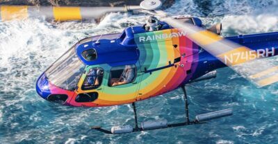
Private Oʻahu Helicopter Experience: All Window Seats
Read our review →
Path to Pali 30-Minute Doors On or Off Helicopter Tour
Read our review →
Path to Pali Passage – 30 Min Helicopter Tour – Doors Off or On
Read our review →Browse the lists this tour appears in